Annual water level measurements begin Jan. 2, December 18, 2019
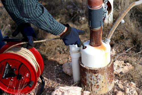
Beginning Jan. 2, HPWD personnel will start water level measurements to determine the effect of 2019 pumping on groundwater levels in aquifers within the district.

These annual measurements are made in a network of more than 1,350 privately-owned wells. These observation wells are spaced at a density of approximately one well per nine square miles throughout the 16-county HPWD service area.
“We want the public to be aware that our staff will be visiting observation well sites from early January until completion of this work effort. They will be driving white pickup trucks that are clearly identified as Water District vehicles,” said HPWD Manager Jason Coleman.
These water level data are made available to the public through an interactive map on the HPWD website (map.hpwd.org).
Persons may access annual observation well data, annual supplemental well data, and daily water level data in select wells using this feature.
“Since its debut in 2013, the interactive map has grown in popularity each year. Most persons utilize this feature to obtain depth-to-water and saturated thickness information,” Coleman said.
An introduction to the interactive map and discussion of each of its features are included in tutorial videos posted to the HPWD YouTube channel.
Those without computer access are encouraged to contact Jed Leibbrandt at the HPWD office to request a printed report of annual water level measurement data for a county or counties of interest.
